Search This Blog

Saturday, February 8, 2020

Pitons

Pitons

 This article is about the Piton mountains of Saint Lucia. For the Pitons of Réunion Island, see Réunion National Park. For the rock climbing tool, see Piton. The Pitons are two mountainous volcanic plugs, volcanic spires, located in Saint Lucia. Gros Piton is 798.25 m (2,618.9 ft) high, and Petit Piton is 743 m (2,438 ft) high; they are linked by the Piton Mitan ridge. The Pitons are a World Heritage Site, 2,909 ha (7,190 acres) in size, and located near the town of Soufrière


Geography

The Pitons are located near the towns of Soufrière, Saint Lucia. Soufrière and Choiseul Quarter Choiseul on the southwestern coast of the island. They are in the electoral districts of three and ten. The Pitons are located on either side of the Jalousie Bay.


Geology

The volcanic complex includes a geothermal field with sulphurous fumaroles and hot springs.


Gros Piton

Gros Piton is at the southern end of Pitons Bay. It is the second-highest peak on Saint Lucia, after Mount Gimie. Gros Piton can be climbed without ropes or mountaineering experience. One can hike to the summit and come back down to the sea-level within several hours. Local guides are available for hire (typically through the resorts) and are trained by the government to have basic knowledge of the languages common among tourists and of the medical procedures required in case of common accidents.


Petit Piton

Petit Piton lies towards the middle of Soufrière Bay, south of Soufrière and north of Gros Piton.
Petit Piton was first climbed in 1878 by Abdome Deligny. The islands of Dominica, Martinique, Barbados, and St. Vincent can be seen from its peak.


In popular culture

Saint Lucia's local brand of beer made by the Windward & Leeward Brewery is named after the Pitons.Both mountains are an attraction for hikers although the Gros Piton peak is more popular since it is an easier climb and tours are offered by The Soufrière Foundation, a non-profit group that is dedicated to help preserve the Pitons Management Area.

Pamukkale

Pamukkale

Pamukkale, meaning "cotton castle" in Turkish, is a natural site in Denizli in southwestern Turkey. The area is famous for a carbonate mineral left by the flowing water.  It is located in Turkey's Inner Aegean region, in the River Menderes valley, which has a temperate climate for most of the year.


The ancient Greco Roman city of Hierapolis was built on top of the white "castle" which is in total about 2,700 metres (8,860 ft) long, 600 m (1,970 ft) wide and 160 m (525 ft) high. It can be seen from the hills on the opposite side of the valley in the town of Denizli, 20 km away.


Known as Pamukkale (Cotton Castle) or ancient Hierapolis (Holy City), this area has been drawing the weary to its thermal springs since the time of Classical antiquity. The Turkish name refers to the surface of the shimmering, snow-white limestone, shaped over millennia by calcium-rich springs. Dripping slowly down the vast mountainside, mineral-rich waters foam and collect in terraces, spilling over cascades of stalactites into milky pools below. Legend has it that the formations are solidified cotton (the area's principal crop) that giants left out to dry.[citation needed]


Tourism is and has been a major industry in the area for thousands of years, due to the attraction of the thermal pools.[1] As recently as the mid-20th century, hotels were built over the ruins of Hierapolis, causing considerable damage.[citation needed] An approach road was built from the valley over the terraces, and motor bikes were allowed to go up and down the slopes. When the area was declared a World Heritage Site, the hotels were demolished and the road removed and replaced with artificial pools.[citation needed]


Overshadowed by natural wonder, Pamukkale's well preserved Roman ruins and museum have been remarkably underestimated and unadvertised; tourist brochures over the past 20 years have mainly featured photos of people bathing in the calcium pools. Aside from a small footpath running up the mountain face, the terraces are all currently off limits, having suffered erosion and water pollution at the feet of tourists.


Geology

  Pamukkale's terraces are made of travertine, a sedimentary rock deposited by water from the hot springs. In this area, there are 17 hot water springs in which the temperature ranges from 35 °C (95 °F) to 100 °C (212 °F). The water that emerges from the spring is transported 320 metres (1,050 ft) to the head of the travertine terraces and deposits calcium carbonate on a section 60 to 70 metres (200 to 230 ft) long covering an expanse of 24 metres (79 ft) to 30 metres (98 ft). When the water, supersaturated with calcium carbonate, reaches the surface, carbon dioxide de-gasses from it, and calcium carbonate is deposited. Calcium carbonate is deposited by the water as a soft gel which eventually crystallizes into travertine.

Machu Picchu

Machu Picchu

Machu Picchu is a 15th-century Inca citadel, located in the Eastern Cordillera of southern Peru, on a 2,430-metre (7,970 ft) mountain ridge. It is located in the Cusco Region, Urubamba Province, Machupicchu District,  above the Sacred Valley, which is 80 kilometres (50 mi) northwest of Cuzco and through which the Urubamba River flows, cutting through the Cordillera and creating a canyon with a tropical mountain climate. 


Most archaeologists believe that Machu Picchu was constructed as an estate for the Inca emperor Pachacuti (1438–1472). Often mistakenly referred to as the "Lost City of the Incas", it is the most familiar icon of Inca civilization. The Incas built the estate around 1450 but abandoned it a century later at the time of the Spanish conquest. Although known locally, it was not known to the Spanish during the colonial period and remained unknown to the outside world until American historian Hiram Bingham brought it to international attention in 1911.


Machu Picchu was built in the classical Inca style, with polished dry-stone walls. Its three primary structures are the Intihuatana, the Temple of the Sun, and the Room of the Three Windows. Most of the outlying buildings have been reconstructed in order to give tourists a better idea of how they originally appeared. By 1976, 30% of Machu Picchu had been restored and restoration continues. 


Machu Picchu was declared a Peruvian Historic Sanctuary in 1981 and a UNESCO World Heritage Site in 1983.  In 2007, Machu Picchu was voted one of the New Seven Wonders of the World in a worldwide Internet poll. 


History

Machu Picchu was built starting 1450–1460. Construction appears to date from two great Inca rulers, Pachacutec Inca Yupanqui (1438–1471) and Túpac Inca Yupanqui (1472–1493). xxxvi There is a consensus among archaeologists that Pachacutec ordered the construction of the royal estate for himself, most likely after a successful military campaign. Though Machu Picchu is considered to be a "royal" estate, surprisingly, it would not have been passed down in the line of succession. Rather it was used for 80 years before being abandoned, seemingly because of the Spanish Conquests in other parts of the Inca Empire. It is possible that most of its inhabitants died from smallpox introduced by travelers before the Spanish conquistadors arrived in the area.


 Geography

Machu Picchu lies in the southern hemisphere, 13.164 degrees south of the equator.  It is 80 kilometres (50 miles) northwest of Cusco, on the crest of the mountain Machu Picchu, located about 2,430 metres (7,970 feet) above mean sea level, over 1,000 metres (3,300 ft) lower than Cusco, which has an elevation of 3,400 metres (11,200 ft). As such, it had a milder climate than the Inca capital. It is one of the most important archaeological sites in South America, one of the most visited tourist attractions in Latin America and the most visited in Peru.

Machu Picchu features wet humid summers and dry frosty winters, with the majority of the annual rain falling from October through to March.


Machu Picchu is situated above a bow of the Urubamba River, which surrounds the site on three sides, where cliffs drop vertically for 450 metres (1,480 ft) to the river at their base. The area is subject to morning mists rising from the river. The location of the city was a military secret, and its deep precipices and steep mountains provided natural defenses. The Inca Bridge, an Inca grass rope bridge, across the Urubamba River in the Pongo de Mainique, provided a secret entrance for the Inca army. Another Inca bridge was built to the west of Machu Picchu, the tree-trunk bridge, at a location where a gap occurs in the cliff that measures 6 metres (20 ft).

The city sits in a saddle between the two mountains Machu Picchu and Huayna Picchu, with a commanding view down two valleys and a nearly impassable mountain at its back. It has a water supply from springs that cannot be blocked easily. The hillsides leading to it were terraced, to provide more farmland to grow crops and to steepen the slopes that invaders would have to ascend. The terraces reduced soil erosion and protected against landslides. Two high-altitude routes from Machu Picchu cross the mountains back to Cusco, one through the Sun Gate, and the other across the Inca bridge. Both could be blocked easily, should invaders approach along them.

Great Ocean Road

Great Ocean Road

The Great Ocean Road is an Australian National Heritage listed 243-kilometre (151 mi) stretch of road along the south-eastern coast of Australia between the Victorian cities of Torquay and Allansford. Built by returned soldiers between 1919 and 1932 and dedicated to soldiers killed during World War I, the road is the world's largest war memorial. Winding through varying terrain along the coast and providing access to several prominent landmarks, including the Twelve Apostles limestone stack formations, the road is an important tourist attraction in the region.

The Great Ocean Road starts at Torquay and travels 243 kilometres westward to finish at Allansford near Warrnambool, the largest city along the road.  The road is two lanes (one in each direction), and is covered by a speed limit changing between 50 kilometres per hour and 100 kilometres per hour.


The road is considered a tourist attraction in the area, in which much of the road hugs coastline affectionately known as the Surf Coast,  between Torquay and Cape Otway, and the Shipwreck Coast further west of Cape Otway, providing visibility of Bass Strait and the Southern Ocean. The road traverses rainforests, as well as beaches and cliffs composed of limestone and sandstone, which is susceptible to erosion. The road travels via Anglesea, Lorne, Apollo Bay, and Port Campbell, the latter being notable for its natural limestone and sandstone rock formations including Loch Ard Gorge, The Grotto, London Arch (formerly London Bridge) and The Twelve Apostles. At the stretch of the Great Ocean Road nearer to Geelong, the road meanders along the coast, with tall, almost-vertical cliffs on the other side of it. Road signs put up along the road warn motorists of possible rockfalls, which have occurred before.


The city of Geelong, close to Torquay, experiences great benefit from Australian and international visitors to the road; with Geelong Otway Tourism affirming it as an invaluable asset. The Royal Automobile Club of Victoria (RACV) listed the road as the state's top tourism experience in its Victoria 101 survey, based on spots recommended by members and the public on what they would recommend to visitors


History

The Great Ocean Road was first planned towards the end of World War I, when chairman of the Country Roads Board, William Calder, asked the State War Council for funds to be provided for returned soldiers to work on roads in sparsely populated areas in the Western District.  At the time, the rugged south-west coast of Victoria was accessible only by sea or rough bush track.  It was envisaged that the road would connect isolated settlements on the coast, and become a vital transport link for the timber industry and tourism. 

Surveying for the road, tentatively titled the South Coast Road, started in 1918 with the road suggested to travel from Barwon Heads, follow the coast west around Cape Otway, and end near Warrnambool. In 1918, the Great Ocean Road Trust was formed as a private company, under the helm of president Howard Hitchcock. The company managed to secure £81,000 in capital from private subscription and borrowing, with Hitchcock himself contributing £3000. Money would be repaid by charging drivers a toll until the debt was cleared, and the road would then be gifted to the state. 


Great Ocean Walk

In 2004, the Great Ocean Walk opened, connecting 104 km of walking trails that follow the coastline near the Great Ocean Road, stretching from Apollo Bay to the 12 Apostles


Banff National Park

Banff National Park

Banff National Park  is Canada's oldest national park and was established in 1885. Located in Rocky Mountains of Alberta, 110–180 kilometres (68–112 mi) west of Calgary, Banff encompasses 6,641 square kilometres (2,564 sq mi) of mountainous terrain, with many glaciers and ice fields, dense coniferous forest, and alpine landscapes. The Icefields Parkway extends from Lake Louise, connecting to Jasper National Park in the north. Provincial forests and Yoho National Park are neighbours to the west, while Kootenay National Park is located to the south and Kananaskis Country to the southeast. The main commercial centre of the park is the town of Banff, in the Bow River valley.


The Canadian Pacific Railway was instrumental in Banff's early years, building the Banff Springs Hotel and Chateau Lake Louise, and attracting tourists through extensive advertising. In the early 20th century, roads were built in Banff, at times by war internees from World War I, and through Great Depression-era public works projects.  Since the 1960s, park accommodations have been open all year, with annual tourism visits to Banff increasing to over 5 million in the 1990s. Millions more pass through the park on the Trans-Canada Highway.  As Banff has over three million visitors annually, the health of its ecosystem has been threatened. In the mid-1990s, Parks Canada responded by initiating a two-year study which resulted in management recommendations and new policies that aim to preserve ecological integrity.


Banff National Park has a subarctic climate with three ecoregions, including montane, subalpine, and alpine. The forests are dominated by Lodgepole pine at lower elevations and Engelmann spruce in higher ones below the treeline, above which is primarily rocks and ice. Mammal species such as the grizzly bear, cougar, wolverine, elk, bighorn sheep and moose are found, along with hundreds of bird species. Reptiles and amphibians are also found but only a limited number of species have been recorded. The mountains are formed from sedimentary rocks which were pushed east over newer rock strata, between 80 and 55 million years ago. Over the past few million years, glaciers have at times covered most of the park, but today are found only on the mountain slopes though they include the Columbia Icefield, the largest uninterrupted glacial mass in the Rockies. Erosion from water and ice have carved the mountains into their current shapes.


History

 Throughout its history, Banff National Park has been shaped by tension between conservationist and land exploitation interests. The park was established on 25 November 1885 as Banff Hot Springs Reserve, in response to conflicting claims over who discovered hot springs there and who had the right to develop the hot springs for commercial interests. The conservationists prevailed when Prime Minister John A. Macdonald set aside the hot springs as a small protected reserve, which was later expanded to include Lake Louise and other areas extending north to the Columbia Icefield. 


 Early history

Archaeological evidence found at Vermilion Lakes indicates the first human activity in Banff to 10,300 B.P.  Prior to European contact, aboriginals, including the Stoneys, Kootenay, Tsuu T'ina, Kainai, Peigans, and Siksika, resided in the region where they hunted bison and other game.

With the admission of British Columbia to Canada on 20 July 1871, Canada agreed to build a transcontinental railroad. Construction of the railroad began in 1875, with Kicking Horse Pass chosen, over the more northerly Yellowhead Pass, as the route through the Canadian Rockies.  Ten years later, on 7 November 1885, the last spike was driven in Craigellachie, British Columbia.


 Geography

 Banff National Park is located in the Rocky Mountains on Alberta's western border with British Columbia in the Alberta Mountain forests ecoregion. By road, the town of Banff is 128 kilometres (80 mi) west of Calgary and 401 km (249 mi) southwest of Edmonton.  Jasper National Park borders Banff National Park to the north, while Yoho National Park is to the west and Kootenay National Park is to the south.[27] Kananaskis Country, which includes Bow Valley Wildland Provincial Park, Spray Valley Provincial Park, and Peter Lougheed Provincial Park, is located to the south and east of Banff. The Trans-Canada Highway passes through Banff National Park, from the eastern boundary near Canmore, through the towns of Banff and Lake Louise, and into Yoho National Park in British Columbia.[26] The Banff townsite is the main commercial centre in the national park. The village of Lake Louise is located at the junction of the Trans-Canada Highway and the Icefields Parkway, which extends north to the Jasper townsite. 

Venice

Venice

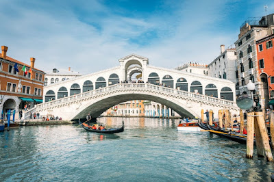
Venesia or Venexia, pronounced  is a city in northeastern Italy and the capital of the Veneto region. It is situated on a group of 118 small islands that are separated by canals and linked by over 400 bridges. The islands are located in the shallow Venetian Lagoon, an enclosed bay that lies between the mouths of the Po and the Piave rivers (more exactly between the Brenta and the Sile). In 2018, 260,897 people resided in the Comune di Venezia, of whom around 55,000 live in the historical city of Venice (centro storico). Together with Padua and Treviso, the city is included in the Padua-Treviso-Venice Metropolitan Area (PATREVE), which is considered a statistical metropolitan area, with a total population of 2.6 million. 


The name is derived from the ancient Veneti people who inhabited the region by the 10th century BC. The city was historically the capital of the Republic of Venice for a millennium and more, from 697 to 1797. It was a major financial and maritime power during the Middle Ages and Renaissance, and a staging area for the Crusades and the Battle of Lepanto, as well as an important center of commerce especially silk, grain, and spice, and of art from the 13th century to the end of the 17th. The city-state of Venice is considered to have been the first real international financial center, emerging in the 9th century and reaching its greatest prominence in the 14th century. This made Venice a wealthy city throughout most of its history. After the Napoleonic Wars and the Congress of Vienna, the Republic was annexed by the Austrian Empire, until it became part of the Kingdom of Italy in 1866, following a referendum held as a result of the Third Italian War of Independence.


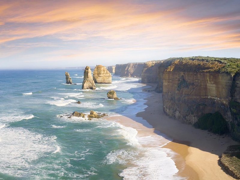
Venice has been known as "La Dominante", "La Serenissima", "Queen of the Adriatic", "City of Water", "City of Masks", "City of Bridges", "The Floating City", and "City of Canals". The lagoon and a part of the city are listed as a UNESCO World Heritage Site. Parts of Venice are renowned for the beauty of their settings, their architecture, and artwork. Venice is known for several important artistic movements especially during the Renaissance period has played an important role in the history of symphonic and operatic music, and is the birthplace of Antonio Vivaldi. 

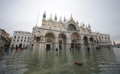
Although the city is facing some challenges (including an excessive number of tourists and problems caused by pollution, tide peaks and cruise ships sailing too close to buildings), Venice remains a very popular tourist destination, a major cultural center, and has been ranked many times the most beautiful city in the world. It has been described by the Times Online as one of Europe's most romantic cities  and by The New York Times as "undoubtedly the most beautiful city built by man". 


History

Although no surviving historical records deal directly with the founding of Venice, tradition and the available evidence have led several historians to agree that the original population of Venice consisted of refugees from nearby Roman cities such as Padua, Aquileia, Treviso, Altino, and Concordia (modern Portogruaro), as well as from the undefended countryside who were fleeing successive waves of Germanic and Hun invasions.  This is further supported by the documentation on the so-called "apostolic families", the twelve founding families of Venice who elected the first doge, who in most cases trace their lineage back to Roman families. Some late Roman sources reveal the existence of fishermen, on the islands in the original marshy lagoons, who were referred to as incolae lacunae ("lagoon dwellers"). The traditional founding is identified with the dedication of the first church, that of San Giacomo on the islet of Rialto (Rivoalto, "High Shore") said to have taken place at the stroke of noon on 25 March 421 (the Feast of the Annunciation). 


Beginning as early as AD 166–168, the Quadi and Marcomanni destroyed the main Roman town in the area, present-day Oderzo. This part of Roman Italy was again overrun in the early 5th century by the Visigoths and, some 50 years later, by the Huns led by Attila. The last and most enduring immigration into the north of the Italian peninsula, that of the Lombards in 568, left the Eastern Roman Empire only a small strip of coastline in the current Veneto, including Venice. The Roman/Byzantine territory was organized as the Exarchate of Ravenna, administered from that ancient port and overseen by a viceroy (the Exarch) appointed by the Emperor in Constantinople. Ravenna and Venice were connected only by sea routes, and with the Venetians' isolation came increasing autonomy. New ports were built, including those at Malamocco and Torcello in the Venetian lagoon. The tribuni maiores formed the earliest central standing governing committee of the islands in the lagoon, dating from c. 568.


The traditional first doge of Venice, Paolo Lucio Anafesto (Anafestus Paulicius), was elected in 697, as written in the oldest chronicle by John, deacon of Venice c. 1008. Some modern historians claim Paolo Lucio Anafesto was actually the Exarch Paul, and Paul's successor, Marcello Tegalliano, was Paul's magister militum (or "general"), literally "master of soldiers". In 726 the soldiers and citizens of the exarchate rose in a rebellion over the iconoclastic controversy, at the urging of Pope Gregory II. The exarch, held responsible for the acts of his master, Byzantine Emperor Leo III, was murdered, and many officials were put to flight in the chaos. At about this time, the people of the lagoon elected their own independent leader for the first time, although the relationship of this to the uprisings is not clear. Ursus was the first of 117 "doges" (doge is the Venetian dialectal equivalent of the Latin dux ("leader"); the corresponding word in English is duke, in standard Italian duca. (See also "duce".) Whatever his original views, Ursus supported Emperor Leo III's successful military expedition to recover Ravenna, sending both men and ships. In recognition of this, Venice was "granted numerous privileges and concessions" and Ursus, who had personally taken the field, was confirmed by Leo as dux. and given the added title of hypatus (from the Greek for "consul").

In 751, the Lombard King Aistulf conquered most of the Exarchate of Ravenna, leaving Venice a lonely and increasingly autonomous Byzantine outpost. During this period, the seat of the local Byzantine governor (the "duke/dux", later "doge"), was at Malamocco. Settlement on the islands in the lagoon probably increased with the Lombard conquest of other Byzantine territories, as refugees sought asylum in the area. In 775/6, the episcopal seat of Olivolo (San Pietro di Castello, namely Helipolis[citation needed]) was created. During the reign of duke Agnello Particiaco (811–827) the ducal seat moved from Malamocco to the more protected Rialto, within present-day Venice. The monastery of St. Zachary and the first ducal palace and basilica of St. Mark, as well as a walled defense (civitatis murus) between Olivolo and Rialto, were subsequently built here.

The Zhangye National Geopark

The Zhangye National Geopark

The Zhangye National Geopark  is located in Sunan and Linze counties within the prefecture-level city of Zhangye, in Gansu, China. It covers an area of 322 square kilometer (124 sq mi). The site became a quasinational geopark on April 23, 2012 (provisional name: Zhangye Danxia Geopark). It was formally designated as "Zhangye National Geopark" by the Ministry of Land and Resources on June 16, 2016 after it has passed the on-site acceptance test. Known for its colorful rock formations, it has been voted by Chinese media outlets as one of the most beautiful landforms in China.


Location

 The park is located in the northern foothills of the Qilian Mountains, in the counties of Linze and Sunan, which are under the administration of the prefecture-level city of Zhangye, Gansu province. The main areas of Danxia landform are in Kangle and Baiyin townships. 

The core area of the park, Linze Danxia Scenic Area, is located 30 kilometer (19 mi) west of downtown Zhangye and 20 kilometer (12 mi) south of the seat of Linze County. It is the most developed and most visited part of the park.  A second scenic area, Binggou , located on the north bank of Liyuan River, was officially inaugurated on 3 August 2014. Binggou covers an area of 300 square kilometers (120 sq mi), and its elevation ranges from 1,500 to 2,500 meters above sea level. A third area, Sunan Danxia Scenic Area, is located in Ganjun, south of Linze.


Landscape

Zhangye Danxia is known for the unusual colours of the rocks, which are smooth, sharp and several hundred meters tall. They are the result of deposits of sandstone and other minerals that occurred over 24 million years. The result (similar to a layer cake), was tilted by the action of the same tectonic plates responsible for creating parts of the Himalayan mountains. Wind, rain, and time then sculpted extraordinary shapes, including towers, pillars, and ravines, with varying colours, patterns, and sizes. 


Media And Tourism

In 2005, Zhangye Danxia was voted by a panel of reporters from 34 major media outlets as one of the most beautiful Danxia landform areas in China. In 2009, Chinese National Geography magazine chose Zhangye Danxia as one of the "six most beautiful landforms" in China. The area has become a top tourist attraction for Zhangye. A series of boardwalks and access roads have been built to help visitors to explore the rock formations. In 2014, 100 million yuan was invested to improve the facilities in the Binggou area.

Zhangye Danxia is featured as a natural wonder in the video game Sid Meier’s Civilization VI. It was added in the Rise and Fall expansion.